Sarasota County
Form-Based Code for Mixed-Use Infill Development
|
This page provides Click
here to go to |
 |
 |
|
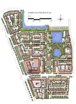
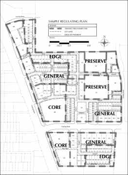
| [click to enlarge either sample plan] | |||
![]()
SUMMARY:
TRADITIONAL NEIGHBORHOOD DESIGN PRINCIPLES:
Proposals for mixed-use development in
unincorporated Sarasota County are now eligible for rezoning to
the new PMI zoning district if they
incorporate the principles of traditional neighborhood design,
including:
i.
A highly interconnected street network, dispersing traffic and
providing convenient routes for pedestrians and bicyclists.
ii.
High-quality public spaces, with all building facades having
windows and doors facing tree-lined streets, plazas, squares, or
neighborhood parks.
iii.
Compact development, creating a walkable urban environment and
conserving land and energy through reduced automobile usage and advanced
techniques such as stormwater infiltration.
iv. Diversity not
homogeneity, with a variety of building types, street types, open
spaces, and land uses providing for people of all ages and every form of
mobility.
v. Resilient and
sustainable neighborhoods, adaptable over time to improved public
transit and to changing economic conditions.
PROCESS FOR REQUESTING THE NEW PMI DISTRICT: The new district provides form-based regulations that can be used to seek approval of a development concept plan formulated during a charrette-based planning process. This planning process would be a prerequisite for petitioning for this district.
APPLICABILITY: Applicants
can request that this district
be applied to sites that meet one of the
following criteria:
i. MIXED-USE CENTERS: On
land designated on the Future Land Use Map as Village I Center, Village
II Center, Community Center, or Regional Center. Land designated as
Major Employment Center also qualifies provided the Major Employment
Center fronts on an arterial street.
ii. REDEVELOPMENT CORRIDORS: Land designated commercial on the Future Land Use Map that front on US 41 from the southern edge of the City of Sarasota to Jacaranda Boulevard; on Bee Ridge Road from US 41 to Interstate 75; or on Stickney Point Road from the Intracoastal Waterway to Swift Road and on Clark Road from Swift Road to Interstate 75.
iii. Land designated commercial on the Future Land Use Map, provided it is located within a designated Village Center or Town Center on the Future Land Use Map.
![]()
FOR DETAILS:
Click below to download the final version and earlier drafts of this code:
-
Final version as adopted by the Board of County Commissioners on August 28, 2007.
-
August 1, 2007, draft for final Board of County Commissioners public hearing on August 28
-
July 1, 2007, draft for Board of County Commissioners public hearing on July 10
-
May 9, 2007, draft for Planning Commission public hearing on May 9.
-
April 5, 2007, draft for review at public workshop on April 23
-
Click here to go to Sarasota County's form-based codes web page.
![]()
SCHEDULE:
- Final Board of County Commissioners public hearing: August 28, 2007
- First Board of County Commissioners public hearing: July 10, 2007
- Board of County Commissioners workshop: May 25, 2007
- Planning Commission public hearing: May 10, 2007
- Public workshop: April 23, 2007
![]()
This code was prepared for the Sarasota County Board of Commissioners by Dover, Kohl & Partners and Spikowski Planning Associates.
